

saveourplanetearth.com
Call us: (775) 831-1331
Hiking Mt. Rose
Mount Rose Wilderness is a protected wilderness area located between Reno and Lake Tahoe and is comprised of 28,000 acres. Treat yourself to an aerial view by making your way to the top of Mount Rose via the Mt. Rose trailhead located at the top of Highway 431.
Billed as a strenuous and difficult hike, it lived up to its name, at least for me. This is a 10+-mile round-trip hike, with an elevation gain of nearly 2,000 feet—topping out at 10,778 feet above sea level.
I decided to hike alone, as I knew I would be taking lots of pictures and did not want anyone to have to wait for me, with a plan to meet up with my daughter and her friends somewhere near the summit, later in the day.
The adventure began almost as soon as my boots hit the ground. I parked below the large parking area at the top of Mt. Rose Highway; perhaps ¼ mile down the road toward Incline Village at the shack on the uphill side of the road.
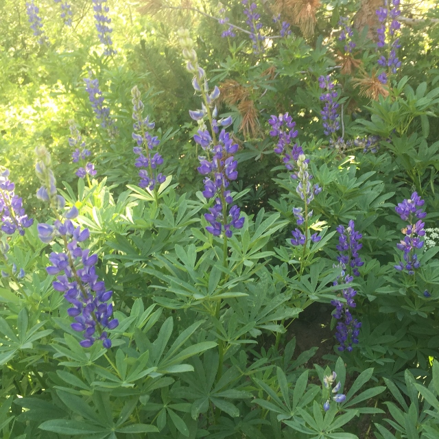
The route I chose was actually not the trail; rather it was an improved dirt road. The road followed Third Creek; therefore I quickly made the acquaintance of several wildflower species, including massive stands of lupine, bunches of sulfur buckwheat and profuse clusters of mountain pennyroyal. The day was starting out very well.
About two miles up this road, shortly after passing Frog Pond, I encountered a sign and decided to follow the arrow towards Mt. Rose Summit. Shortly after that is another sign: Mt. Rose summit straight ahead, with the Tahoe Rim Trail (TRT) going right and left. The Mt. Rose summit trail went down, so I initially chose the Tahoe Rim Trail to the right, but then decided to turn around and go down the Mt. Rose summit trail. I figured out later, I could have continued on the TRT as they intersected at the bottom of the valley.
Going left onto the TRT at that point would lead a hiker along the ridgeline to Relay Peak, Mud Lake, Mount Baldy, Martis Peak, and eventually to Brockway Summit.
Down in the valley, I met another solitary hiker heading up the trail whence I had just come so I asked him if he had come from the summit. He said he was heading toward the summit so we conferred and decided that the both of us would continue the way I was going. As we were passing through the valley, we ran into another hiker who thought he was heading for the summit but we convinced him to continue with us—a good thing, because we soon determined we were indeed going the right way, toward the summit of Mount Rose.
Up until now, the hike was not strenuous at all but after passing the valley, we began to climb. According to the signs, we had about three miles to go from here, and as we ascended, the air became noticeably thinner.
We stopped for a rest under a tree and happened to look up to see a pair of red-tailed hawks soaring lazily above our heads.
As we climbed, the trees became sparse, until we emerged entirely from the tree line—that’s when it got really tough—and no shade.
Dusty, sweaty and with aching legs, we made it to the top, grateful for the nice breeze. In fact, even at noon, it was a little chilly at 10,778 feet. The view is spectacular, even though the area was bathed in haze from the smoke.
To the northeast, Reno is clearly visible. To the northwest, you can see Boca, Stampede and Prosser Reservoirs. To the east is Truckee and Donner Lake, to the west, Washoe Lake. And of course, look south to see Lake Tahoe. In a sense, it’s like being on top of the world.
After having lunch at the top, I bid adieu to my ascending partners and made the descent with my daughter and her friends. Once back in the valley, we continued to the water falls and the basically flat trail to the main parking lot.
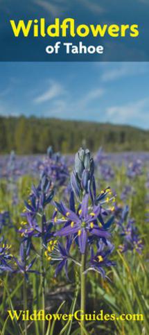
After some consultation with Hannah Sullivan, self-taught wildflower expert and co-author of the pamphlet “Wildflowers of Tahoe”, I was able to identify the various species of wildflowers seen along the way. Visit tahoetshirtsandgifts.com to purchase the pamphlet which can aid you in identifying the wildflowers found along this and any other hike in the basin.
Be sure to wear sturdy shoes and carry plenty of water. Make your way to the top at a comfortable pace. My legs shouted at me for five days afterwards but it was worth it.
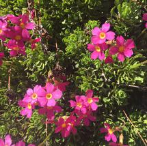
Sierra Primrose
Photo courtesy of Hannah Sullivan
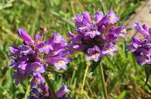
Penstemon
Photo courtesy of Hannah Sullivan
Large-leaf lupine
Photo courtesy of Hannah Sullivan